The tour starts directly at Nenzing railway station at around 508 metres above sea level. The first few kilometres are comparatively gentle and mostly paved, following Bahnhofstraße and Gaisstraße through Nenzing. The long climb begins after roughly two kilometres.
Side roads and the Gamperdonaweg lead towards Stellveder. The surface remains largely paved until around kilometre five. The route then changes to a forest and farm track, with gravel dominating from approximately kilometre 5.4. Between kilometre two and the turning point, the route gains roughly 950 net metres of elevation at an average net gradient of just under eight per cent.
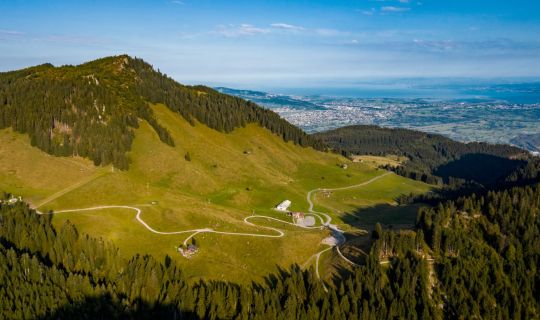
The track climbs in numerous bends through woodland and open mountain terrain on the Nenzingerberg. St Martin’s Chapel stands a short distance off the route in the area of the former mountain settlement. Higher up, the track passes directly by Nenzingerberg Alpe before continuing along the farm track towards Valscherina.
After around 13.9 kilometres, the turning point is reached near Valscherina Hut. The Alpine Club hut stands at approximately 1,462 metres, while the GPX track reaches its highest point in this area at around 1,480 metres. The open alpine landscape provides a quiet contrast to the long climb.
The return follows largely the same way back. First comes the long gravel descent across the Nenzingerberg, followed by paved roads from Stellveder back to Nenzing. An appropriate speed is especially important on loose surfaces. The final kilometres become flatter again before reaching Nenzing railway station.