Details
| Highest point | 1319 m |
| Jan | Feb | Mar | Apr | May | Jun |
| Jul | Aug | Sep | Oct | Nov | Dec |
This challenging mountain bike circuit leads from the historic centre of Hohenems via Alpe Gsohl and Emser Hütte into the alpine landscape below Schöner Mann. The route continues past Schönermannalpe and Hinterbergalpe to Schuttannen before descending back into the valley.
Covering approximately 20.3 kilometres and 1,120 metres of ascent, the route includes long and at times very steep climbs on forest and gravel tracks. Very good fitness and confident bike handling are required. Views across the Rhine Valley and several places to stop for refreshments characterise the higher sections.
The circuit starts at Stoffels Säge-Mühle near Schlossplatz in Hohenems. The historic mill museum recalls the long tradition of using water power along the Emsbach stream. From Schlossplatz, the route passes through the archway, turns immediately right across the bridge and climbs along Emsbachstraße. It then follows Hochquellenstraße towards the shooting range, where the long ascent into the alpine landscape begins.
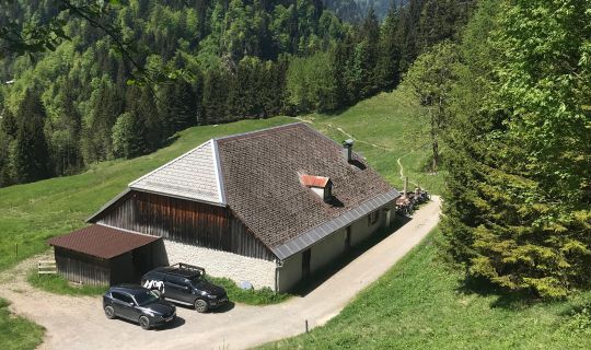
A forest track climbs through predominantly wooded terrain towards Alpe Gsohl. The continuously steep ascent gains height quickly and occasionally opens up views across the Rhine Valley. At Gsohlälpele, at an elevation of around 980 metres, the route continues along Gsohlweg towards Fluhereck.
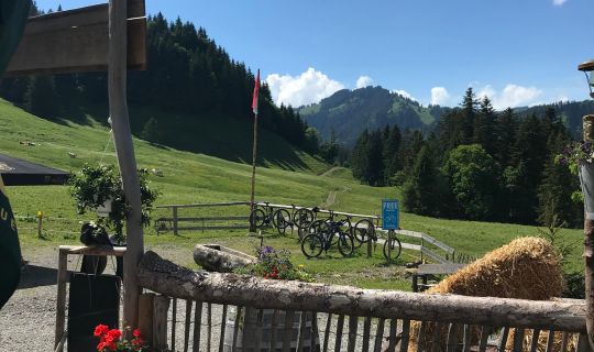
Near Fluhereck, the route reaches Emser Hütte. From here, it follows the main Gsohlweg towards Schönermannalpe. Alpine meadows and mountain forest define this scenic high-level section below Schöner Mann. The route then continues via Hinterbergalpe to Schuttannen. At the junction at approximately kilometre 11.9, remain on the main route and do not turn towards Springhalde.
In Schuttannen, the route passes Gasthaus Schiheim and Berggasthof Schuttannen. After the highest and most panoramic section, the long descent begins. The public mountain road leads via Emsreute and Reutestraße back to Hohenems.
Back in the valley, the route returns to Schlossplatz and Stoffels Säge-Mühle. Palast Hohenems, St Karl parish church and the historic town centre provide a cultural conclusion to this physically demanding circuit.
The starting and finishing point is Stoffels Säge-Mühle, Sägerstraße 11, 6845 Hohenems, near Schlossplatz.
By public transport
Bus stop at the start/finish: Hohenems Schlossplatz, served by bus routes 170, 175, 180 and 185, among others.
Railway station at the start/finish: Hohenems railway station. Several bus routes run from the station to the Schlossplatz stop. Alternatively, the starting point can be reached within a few minutes by bicycle.
Travelling by train and bus allows you to start the route without searching for a parking space.
Plan your journey at vmobil.at
By car
Leave the A14 at the Hohenems exit and follow the signs towards the town centre and Schlossplatz. The starting point is at Stoffels Säge-Mühle, Sägerstraße 11.
Parking
The recommended option is the official Rathausgarage on Diepoldsauer Straße. It is only a few minutes from the starting point and provides secure, weather-protected parking. The car park is managed; please observe the current conditions displayed on site.
A well-maintained mountain bike with grippy tyres and reliable brakes is recommended. A cycle helmet, weather-appropriate clothing, gloves, sufficient drinks and food are essential.
Because of the long and steep climbs, carry a repair kit, spare inner tube or tubeless repair equipment, pump, mobile phone and an up-to-date route map or GPS navigation device.
The route is graded difficult because of its long, sometimes very steep climbs and the descent. Very good fitness, confident bike handling and controlled braking are essential. Expect loose surfaces, ruts and debris on gravel and forest tracks.
Some sections use managed forest tracks and public roads. Be considerate of walkers, agricultural vehicles and oncoming traffic, adjust your speed and close all pasture gates. Steep sections may be particularly slippery when wet.
Check the weather, trail conditions and opening times of refreshment stops before setting out. Weather conditions can change quickly in the alpine area.
Emergency information
140 Alpine emergencies throughout Austria
144 Alpine emergencies in Vorarlberg
112 European emergency number
Further safety information: vorarlberg.travel/en/safety-tips
Refreshment stops
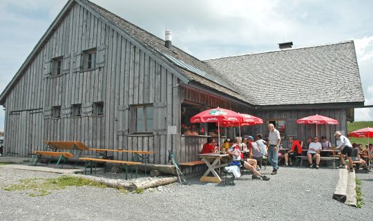
Alpe Gsohl, Emser Hütte, Gasthaus Schiheim and Berggasthof Schuttannen are located along the route. Opening and operating times vary according to season and weather and should be checked in advance.
Cultural information
Stoffels Säge-Mühle at the starting point documents around 2,000 years of milling technology and the historic use of water power in Hohenems. Schlossplatz, Palast Hohenems and St Karl parish church are also located directly on the route.
Further information
Tourismus & Stadtmarketing Hohenems: hohenems.travel/en
Safety advice for outdoor activities: vorarlberg.travel/en/safety-tips