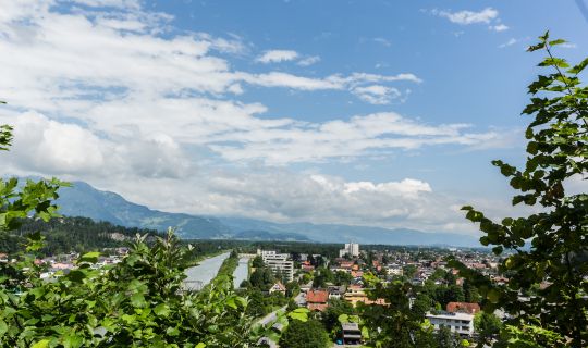
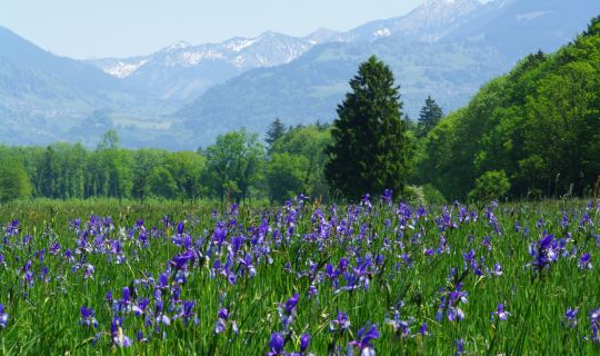
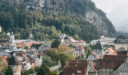
Ill bei Nenzing

Circuit cycle tour from Nenzing along the river Ill

This varied circular cycle tour starts at Nenzing railway station and links the Walgau valley floor with the higher-lying settlements of Latz and Gampelün. Over approximately 17.8 kilometres, the scenery alternates between views of the surrounding mountains, small chapels, rural hamlets and the landscape around the River Ill.

With around 265 metres of ascent, the circuit requires a good basic level of fitness: the climb towards Latz is particularly noticeable, followed later by a longer descent. Predominantly surfaced paths and roads make the tour appealing to cyclists who would like to combine a manageable distance with a sporty climb and a few cultural discoveries.

Details

Fitness
      
Landscape
      
Difficultymoderate
Experience
      
Highest point720 m
Lowest point472 m
Best time of year
JanFebMarAprMayJun
JulAugSepOctNovDec
Kurzbeschreibung

Diese abwechslungsreiche Radrunde beginnt beim Bahnhof Nenzing und verbindet den Talraum des Walgaus mit den höher gelegenen Siedlungen Latz und Gampelün. Auf der rund 17,8 Kilometer langen Strecke wechseln sich Ausblicke auf die umliegenden Berge, kleine Kapellen, ländliche Ortsteile und die Landschaft im Umfeld der Ill ab.

Mit etwa 265 Höhenmetern im Anstieg verlangt die Runde eine gute Grundkondition: Vor allem die Auffahrt in Richtung Latz ist spürbar steil, später folgt eine längere Abfahrt. Überwiegend befestigte Wege und Straßen machen die Tour für Radfahrer:innen interessant, die eine überschaubare Distanz mit einem sportlichen Anstieg und kulturellen Entdeckungen verbinden möchten.

Tourenbeschreibung

Die Runde startet beim Bahnhof Nenzing und führt die Bahnhofstraße entlang bevor sie an der Meng angekommen auf der Bazulstraße weiter führt.

Auf der Bazulstraße führt die Tour bergauf in Richtung Latz, vorbei am Alpencamping Nenzing. Dieser Anstieg zählt zu den konditionell anspruchsvollsten Abschnitten der Runde: Auf wenigen Kilometern wird ein erheblicher Teil der Höhenmeter zurückgelegt. Die Straße ist in den erfassten Bereichen asphaltiert.

Im Bereich von Latz setzt sich die Fahrt durch die höher gelegene Siedlungslandschaft fort. Anschließend führt die Runde nach Gampelün. Die Hangterrassen öffnen den Blick auf die Berge des Walgaus. Direkt an der Strecke steht die Lourdeskapelle von Gampelün, die 1901 anstelle eines älteren Bildstocks errichtet wurde. In diesem Abschnitt liegt auch der höchste Punkt der Tour auf rund 720 Metern Seehöhe.

Nach Gampelün geht es durch die Gegend von Halden und Mittelberg wieder bergab. In Halden passiert die Tour die Kapelle Maria Schnee. Die Strecke führt weiter durch eine Landschaft mit verstreuten Häusern, Wiesen und bewaldeten Hängen; auch die Flurnamen Roßnis und Rober gehören zu diesem Abschnitt. Die längere Abfahrt erfordert auf den teilweise stärker geneigten Straßen eine kontrollierte Geschwindigkeit.

Anschließend führt die Runde aus dem Hanggebiet zurück in die tieferen Lagen des Walgaus. In Frastanz biegt die Strecke Richtung Ill ab. Der landschaftliche Charakter verändert sich: Statt der Ausblicke von den Höhen stehen nun die offene Talebene und die Umgebung der Ill im Vordergrund. Die späteren Kilometer verlaufen vergleichsweise flach; auf Teilen des Rückwegs sind asphaltierte Wege ausgewiesen.

Anschließend Führt die Runde entlang der Ill und über den Bereich Beschling. In der Umgebung von Beschling liegt der archäologisch bedeutende Brandopferplatz Scheibenstuhl etwas abseits der Strecke; er erinnert an die lange Besiedlungs- und Kultgeschichte dieses Teils des Walgaus. Hinter Beschling geht es wieder zurück Richtung Bahnhof Nenzing. Da es sich um eine Rundtour handelt, ist ein Einstieg auch an anderen geeigneten und verkehrlich gut erreichbaren Punkten entlang der Strecke möglich.

Anreise

Ausgangspunkt und Ziel der Tour ist der Bereich beim Bahnhof Nenzing, Bahnhofstraße 58, 6710 Nenzing.

Mit den öffentlichen Verkehrsmitteln

Bushaltestelle Start/Ziel: Nenzing Bahnhof, unmittelbar beim Ausgangspunkt.

Zughaltestelle Start/Ziel: Nenzing Bahnhof, unmittelbar beim Ausgangspunkt.

Die Anreise mit Bahn und Bus ermöglicht einen direkten Start ohne Parkplatzsuche.

Hier der Link zur Anreiseplanung: vmobil.at

Mit dem Auto

Nenzing ist über die regionalen Straßen im Walgau erreichbar. Von der Hauptstraße führt die Bahnhofstraße direkt zum Bahnhof und zum Ausgangspunkt der Tour.

Parken

Empfohlen wird die Park-&-Ride-Anlage Nenzing beim Bahnhof, erreichbar von der Hauptstraße über die Bahnhofstraße. Aktuelle Bedingungen sind vor Ort zu beachten.

Ausrüstung

Empfohlen wird ein verkehrssicheres Touren- oder Trekkingrad mit einer gut abgestuften Schaltung für den längeren Anstieg und zuverlässigen Bremsen für die Abfahrt. Sinnvoll sind Fahrradhelm, Trinkwasser, wetterangepasste Kleidung und ein kleines Reparaturset. Für mögliche kurze unbefestigte oder verschmutzte Abschnitte empfiehlt sich eine alltagstaugliche, nicht zu schmale Bereifung.

Sicherheitshinweise

Der Anstieg von Nenzing in Richtung Latz erfordert ausreichend Kondition; die folgende Abfahrt über Gampelün und Halden verlangt eine angepasste Geschwindigkeit und sicheres Bremsen. Auf den Landes- und Verbindungsstraßen ist mit Kraftfahrzeugen zu rechnen. Besonders in Kurven, an Einmündungen und bei Ortsdurchfahrten sind Aufmerksamkeit und Rücksicht auf andere Verkehrsteilnehmer:innen wichtig.

Nach Regen können Fahrbahnverunreinigungen, Laub und feuchte Stellen die Bodenhaftung beeinträchtigen. Auf Wegen in der Umgebung der Ill ist Rücksicht auf Fußgänger:innen und die Natur zu nehmen. Beschilderungen, mögliche Sperren und lokale Fahrverbote sind zu beachten. Vor der Fahrt empfiehlt sich ein Blick auf die Wettervorhersage und den aktuellen Wegzustand.

Zusatzinformationen

Einkehrmöglichkeiten

Vor oder nach der Runde bieten sich gastronomische Betriebe im Ortsgebiet von Nenzing für eine Pause an. Bei einer Einkehr unterwegs sollten aktuelle Öffnungszeiten und gegebenenfalls saisonale Betriebszeiten vorab geprüft werden.

Weitere Informationen

Die Lourdeskapelle in Gampelün und die Kapelle Maria Schnee in Halden setzen kleine kulturelle Akzente entlang der Runde. Etwas abseits der Strecke liegt bei Beschling der Brandopferplatz Scheibenstuhl, dessen Geschichte bis in die vorchristliche Zeit zurückreicht. Für zusätzliche Zeit in der Umgebung bietet sich das Naherholungsgebiet Galinawald zwischen Beschling und den höher gelegenen Parzellen an.

Detailed description

The circular tour starts at Nenzing railway station and follows Bahnhofstraße until it reaches the Meng stream, where it continues along Bazulstraße.

The route climbs along Bazulstraße towards Latz, passing Alpencamping Nenzing. This ascent is one of the most physically demanding sections of the tour, with a considerable amount of elevation gained over just a few kilometres. The road is surfaced with tarmac along the documented sections.

Around Latz, the route continues through settlements at a higher elevation before heading towards Gampelün. The hillside terraces offer views of the mountains of the Walgau region. Directly along the route stands the Lourdes Chapel in Gampelün, built in 1901 on the site of an older wayside shrine. This section also includes the highest point of the tour, at approximately 720 metres above sea level.

After Gampelün, the route descends through the areas of Halden and Mittelberg. In Halden, the tour passes the Maria Schnee Chapel. The route continues through a landscape of scattered houses, meadows and wooded hillsides, including the areas known as Roßnis and Rober. The longer descent requires controlled speed, particularly on the steeper sections of road.

The circular tour then leaves the hillside areas behind and returns to the lower elevations of the Walgau Valley. In Frastanz, the route turns towards the Ill river. The character of the landscape changes: instead of views from the hills, the open valley floor and the surroundings of the Ill now take centre stage. The later kilometres are relatively flat, with sections of the return route following tarmac paths.

The route then continues alongside the Ill and through the Beschling area. Near Beschling, the archaeologically significant Scheibenstuhl burnt-offering site lies a short distance from the route, offering a reminder of the long history of settlement and cultural traditions in this part of the Walgau region. Beyond Beschling, the route returns towards Nenzing railway station. As this is a circular tour, it is also possible to join the route at other suitable and easily accessible points along the way.

Getting there

The tour starts and finishes near Nenzing railway station, Bahnhofstraße 58, 6710 Nenzing.

By public transport

Bus stop at the start/finish: Nenzing Bahnhof, immediately next to the starting point.

Train station at the start/finish: Nenzing railway station, immediately next to the starting point.

Travelling by train and bus allows you to start the route without searching for a parking space.

Plan your journey at vmobil.at

By car

Nenzing can be reached via the regional roads through the Walgau valley. From the main road, Bahnhofstraße leads directly to the railway station and the starting point of the tour.

Parking

Nenzing Park & Ride at the railway station, accessible from the main road via Bahnhofstraße. The official parking spaces are immediately beside the starting point. The car park is managed; please observe the current conditions displayed on site.

Equipment

A roadworthy touring or trekking bike with suitably low gears for the longer climb and reliable brakes for the descent is recommended. A cycle helmet, drinking water, clothing suited to the weather and a small repair kit are useful. Practical tyres that are not too narrow are advisable in case of short unsurfaced or dirty sections.

Safety information

The climb from Nenzing towards Latz requires a reasonable level of fitness, while the subsequent descent via Gampelün and Halden calls for an appropriate speed and confident braking. Motor traffic should be expected on the regional roads and connecting roads. Particular care and consideration for other road users are important on bends, at junctions and when passing through settlements.

After rain, dirt, leaves and damp patches can reduce grip. On paths around the River Ill, cyclists should be considerate towards pedestrians and the natural environment. Signs, temporary closures and local cycling restrictions must be respected. Checking the weather forecast and current route conditions before setting off is recommended.

Additional information

Dining Options

Restaurants and cafés in Nenzing offer opportunities for a break before or after the circuit. Anyone planning a stop for refreshments along the way should check current opening hours and any seasonal restrictions in advance.

Further Information

The Lourdes Chapel in Gampelün and the Maria Schnee Chapel in Halden add small cultural highlights along the route. A little way off the route near Beschling is the Scheibenstuhl ritual offering site, whose history reaches back to pre-Christian times. For those wishing to spend more time nearby, the Galinawald recreation area between Beschling and the higher-lying hamlets is another option.

Tour-Quickfacts
Difficulty
moderate
Distance
17,8 km
Duration
01:55h
Ascent
213m
Descent
240m