Details
| Highest point | 691 m |
| Jan | Feb | Mar | Apr | May | Jun |
| Jul | Aug | Sep | Oct | Nov | Dec |
This moderately difficult mountain bike circuit links the forest tracks around Amberg with Feldkirch’s old town, the slopes near Tisis and Schellenberg. Between Schloss Amberg, Schattenburg, the banks of the River Ill and Tosters, the route alternates between forest tracks, minor roads and urban cycle links.
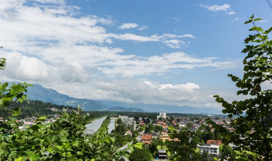
Several climbs and descents provide plenty of sporting variety, with changing views of Feldkirch and the Rhine Valley along the way. The circuit is suitable for experienced mountain bikers with a good level of fitness.
The circuit starts at Feldkirch Amberg railway station. It initially follows a path close to the railway line northwards. After passing beneath the A14, the route joins Tillisweg, briefly follows Rheintalweg Vorarlberg and then climbs through the Föhrenwald to Schloss Amberg.
The next woodland section begins at the castle. The route follows Neuen Viereckweg and Hohen Sattelweg along forest tracks towards Göfis. After the climb, it descends along the L66 to Schattenburg. The transition from peaceful woodland to the historic townscape is a defining feature of this section.
From Schattenburg, the route passes Rösslepark and continues through the town centre to the River Ill. Cycle-priority streets and cycle paths then lead towards Felsenau. Felsenau swimming pool is located directly on the route and provides a convenient place to stop during the swimming season.
At the swimming pool, the circuit turns back into the woods and climbs towards Maria Grün. It then follows Weiherstraße and Letzestraße to Tisis. Gallmiststraße, Kehrstraße and a short section of Liechtensteiner Straße link the urban part of the route with the quieter roads towards Ried and Hub.
Legerstraße, Grißstraße and Riedweg lead to Hubstraße. The route then climbs to Schellenberg via Am Schellenberg and Rütteleweg. This longer section passes through peaceful rural surroundings. Gasthaus zur Eibe offers an opportunity to stop for refreshments before the route descends to Tosters along Rheintalweg Vorarlberg.
The circuit continues along Egelseestraße, past Vorarlberghalle and towards the cycle path at Vereinigungsbrücke. The final kilometres pass the district court, follow Hirschgraben and lead through the underpass at Sparkassenplatz to Levis. After the secondary school and vocational school, the route turns onto Tränkeweg, crosses the regional road and returns to Feldkirch Amberg railway station.
We recommend travelling to the starting point by public transport. Feldkirch Amberg railway station is both the starting and finishing point of the circuit.
By public transport
Railway station at start/finish: Feldkirch Amberg
Feldkirch Amberg railway station is served by S-Bahn line S1. Direct services are available from Bregenz, Dornbirn, Hohenems, Götzis, Rankweil, Feldkirch and Bludenz, among other places. The tour can be started directly from the station.
Plan your journey here: vmobil.at
By car
From Bregenz, take the A14 to the Feldkirch-Nord exit. When travelling from Bludenz, use the Feldkirch/Frastanz exit. Continue towards Feldkirch-Amberg and follow Logergasse and Kalkofenweg to the railway station.
A valid motorway vignette is required when travelling on the toll section of the A14.
Parking
Parking is available at Feldkirch-Amberg railway station, Logergasse/Kalkofenweg 1. Access is via Kalkofa. Please check charges, availability and current regulations on site.
Good equipment is recommended for this cycle tour: a cycle helmet, a cycling backpack if required, comfortable footwear or cycling shoes, clothing suitable for the weather, sun and rain protection, a bicycle pump if required, bicycle tools, a spare inner tube or puncture repair kit, food and sufficient drinking water, a first-aid kit and a mobile phone.
A mechanically sound mountain bike with grippy tyres and fully functioning brakes is required for the woodland, forest-track and gravel sections. Due to the many junctions, a navigation device or app with the latest GPX track is also recommended.
The tour follows woodland paths, forest tracks, minor roads and cycle paths, as well as short sections of busier roads. Particular care is required on the L66, Liechtensteiner Straße and at road crossings.
The descents from Hohen Sattel towards Göfis and from Schellenberg to Tosters can be fast in places. Speed and riding style should be adapted to the surface, visibility and oncoming traffic. After rain, gravel, roots, leaves and damp woodland paths may be slippery.
On shared-use routes, please show consideration for pedestrians, other cyclists and agricultural and forestry vehicles. Grazing fences, path closures and local signs must be observed.
Check the weather, route conditions and any possible closures before setting off. The tour should not be ridden during strong winds, thunderstorms, snow or icy conditions. Use of the route is at your own risk.
EMERGENCY NUMBERS
112 European emergency number
140 Mountain rescue
144 Ambulance service
Best time of year
April to November, provided the woodland paths and forest tracks are free from snow and ice. After prolonged rainfall, some sections may be soft or slippery.
Refreshments and rest stops
Places to stop for food and drink can be found in Feldkirch town centre, at Rösslepark and at Gasthaus zur Eibe in Tosters. Opening times and closing days should be checked before setting off.
Places for a short rest can be found at Schloss Amberg, along the River Ill and around Schellenberg.
Swimming
Felsenau swimming pool is located directly on the route and provides an opportunity to cool off during the swimming season. Please check opening times, admission charges and current regulations in advance.
Suitability
The tour is suitable for experienced mountain bikers with a good level of fitness and confident bike-handling skills on gravel and forest tracks. It is not accessible and, due to the climbs, descents and road sections, is not suitable for families with young children.
Shortening the route
The circuit can be shortened within the urban area if necessary. Various cycle links lead from Tisis, Tosters and the town centre back to Levis and Amberg. The preferred shortcut should be planned in advance using the map or GPX track.
Navigation
Due to the numerous changes between roads and tracks, use of the GPX track is recommended. Particular attention should be paid to navigation in Tisis, around Hub and on the return journey through Tosters and Levis.