.jpg.jpeg

Mountain bike circuit from Rankweil via Übersaxen and the Dünser Älpele

This demanding mountain bike circuit starts at Rankweil station and climbs via Valduna, Übersaxen and the Gulmalpe to the Dünser Älpele. Covering around 36 kilometres and 1,200 metres of ascent, it requires excellent fitness, strength and confident bike handling.

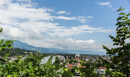
The long climb is rewarded with wide-ranging views across the Rhine Valley, the Rätikon range and, on clear days, as far as the Silvretta.

The circuit is suitable for experienced mountain bikers. You can also join it at other suitable points along the route.

Details

Difficultydifficult
Highest point1579 m
Best time of year
JanFebMarAprMayJun
JulAugSepOctNovDec
Short description

This demanding mountain bike circuit starts at Rankweil station and climbs via Valduna, Übersaxen and the Gulmalpe to the Dünser Älpele. Covering around 36 kilometres and 1,200 metres of ascent, it requires excellent fitness, strength and confident bike handling.

The long climb is rewarded with wide-ranging views across the Rhine Valley, the Rätikon range and, on clear days, as far as the Silvretta.

The circuit is suitable for experienced mountain bikers. You can also join it at other suitable points along the route.

Route description

The circuit begins at Rankweil station and climbs via Valduna to Übersaxen. Minor roads, mountain roads and forest tracks lead steadily up towards the Gulmalpe.

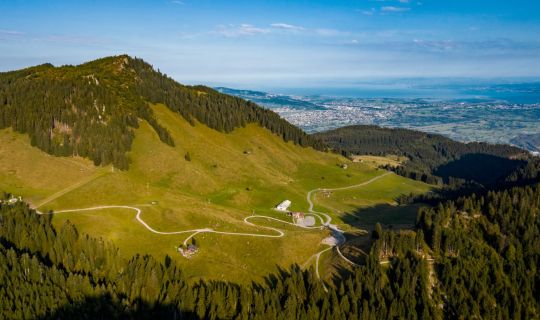
Above Übersaxen, the surface changes between tarmac, forest tracks and steeper sections. A short section before the Eggalpe may be too steep to ride uphill. The route then continues to the Dünser Älpele at around 1,580 metres.

The descent leads via Dünserberg, Düns and Satteins through woodland, meadows and small settlements before returning across the valley floor to Rankweil.

Getting there

The tour starts and finishes at Rankweil station.

By public transport

Bus stop at the start/finish: Rankweil station

Train station at the start/finish: Rankweil station

Rankweil is well served by rail and bus. The route starts directly at the station.

Journey planner: vmobil.at

By car

Rankweil can be reached via the A14 and the regional road network.

Parking

Public parking is available at Rankweil station.

Equipment

A mechanically sound mountain bike, a helmet, clothing suitable for the weather, enough food and drink are essential.

The long climb and descent on changing surfaces require fitness, strength and confident bike-handling skills.

Safety information

The route partly follows public roads, forest tracks and agricultural paths. Ride with care, observe the traffic rules and show consideration for other trail users.

Take particular care on steep, wet or loose gravel sections. Severe weather, heavy rain or lingering snow can make individual sections more difficult or impassable.

EMERGENCY NUMBER

112 European emergency number (works from any mobile phone on any network)

Additional information

Please observe the applicable mountain-bike rules and any temporary notices on site. On alpine and forest tracks, you may encounter agricultural traffic and grazing livestock.

Author: Bodensee-Vorarlberg Tourismus GmbH / Rudolf Mayerhofer
Tour-Quickfacts
Difficulty
difficult
Distance
35,4 km
Duration
06:00h
Ascent
1200m
Descent
1200m