.jpg.jpeg

Circular cycle route from Feldkirch via Rankweil, Göfis and Frastanz

This easy circular cycle route links Feldkirch with the neighbouring municipalities of Rankweil, Göfis and Frastanz. Quiet side roads, cycle paths alongside streams, a short gravel section and trails beside the River Ill provide plenty of variety.

The route passes through residential areas, across open countryside and through the Frastanzer Ried wetlands. At 16.2 kilometres with around 120 metres of ascent, it is ideal for a short outing on a gravel bike, trekking bike or sturdy touring bike.

Details

Difficultyeasy
Highest point531 m
Best time of year
JanFebMarAprMayJun
JulAugSepOctNovDec
Overview

This easy circular cycle route links Feldkirch with the neighbouring municipalities of Rankweil, Göfis and Frastanz. Quiet side roads, cycle paths alongside streams, a short gravel section and trails beside the River Ill provide plenty of variety.

The route passes through residential areas, across open countryside and through the Frastanzer Ried wetlands. At 16.2 kilometres with around 120 metres of ascent, it is ideal for a short outing on a gravel bike, trekking bike or sturdy touring bike.

Route description

The circular route starts at Feldkirch Busplatz. After passing through the cycle path underpass, the route follows Fidelisstraße, Mutterstraße and Rebberggasse through the northern districts of Feldkirch.

It continues via Tränkleweg and Reichsstraße to Tafernstraße. After the level crossing, the route passes the Altenstadt football pitch and continues towards Rankweil. There, it follows a quiet shared footpath and cycle path alongside the Nafla.

At Gasthof Sternen-Bräu, the route turns onto the cycle path. A short gravel section begins where the path ends. Römerstraße then climbs gently towards Göfis, offering occasional views across the Walgau valley and the surrounding mountain slopes.

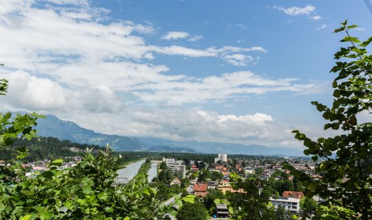
After the descent, the route crosses the River Ill and follows the riverside cycle path upstream. It passes through the grounds of Gärtnerei Kopf and crosses the Samina on a wooden footbridge. From there, red-and-white cycle route signs indicate the way ahead.

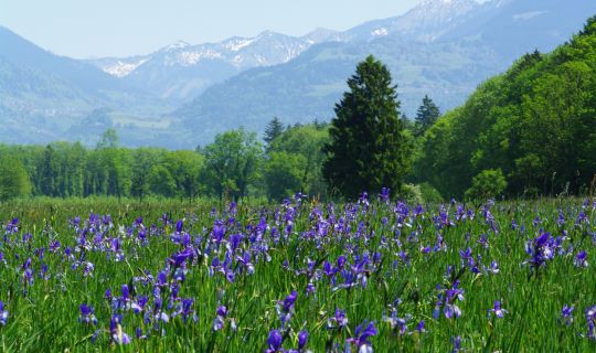
After crossing a regional road, the route continues along a narrow asphalt road through the Frastanzer Ried wetlands. Open meadows and the nearby River Ill characterise this peaceful section. The cycle path towards Feldkirch then leads back to the Busplatz.

Getting there

Feldkirch Busplatz is the recommended starting point. The start and finish of the circular route are located directly beside the Busplatz.

By public transport

Bus stop at the start and finish: Feldkirch Busplatz

Railway station: Feldkirch railway station

Numerous local and regional bus services stop at the Busplatz. From Feldkirch railway station, the starting point can be reached by city bus or by a short onward cycle.

Journey planning: vmobil.at

By car

Depending on your direction of travel, take the A14 motorway to either the Feldkirch-Nord or Feldkirch-Frastanz exit. Then follow the signs towards the town centre and Busplatz. A valid motorway vignette is required to use the A14.

Parking

The Tiefgarage Busplatz underground car park is located directly at the starting point at Hirschgraben 4. A further parking option is the Prenn-Parkplatz car park on Wichnergasse near Feldkirch railway station.

Parking is generally subject to a charge. Please check availability, current charges and applicable regulations locally.

Equipment

Good equipment is recommended for this cycle tour: a cycle helmet, a cycling rucksack if required, comfortable footwear, cycling shoes if appropriate, clothing suitable for the weather, sun and rain protection, a pump if needed, bicycle tools, a spare inner tube, provisions and sufficient drinking water, a first-aid kit, a mobile phone, ...

Sturdy tyres with sufficient tread are advisable due to the short gravel section. Check the brakes, tyre pressure and lights before setting off.

Safety information

The route follows cycle paths, side roads, short sections in mixed traffic and a gravel track. Consideration for other users and an appropriate speed are particularly important on shared footpaths and cycle paths.

The turn-off from Tränkleweg has poor visibility. Particular care is also required at the subsequent crossing of the regional road, at the level crossing on Tafernstraße and at all other road crossings.

At the end of the gravel track, turn left and then shortly afterwards right into Römerstraße. The transitions between gravel and asphalt may be loose or uneven.

The wooden footbridge over the Samina can become slippery when wet. After heavy rainfall, paths beside the River Ill and through the Frastanzer Ried may be wet, muddy or temporarily difficult to ride.

EMERGENCY NUMBERS:

112 European emergency number

144 Ambulance service

Additional information

Food and rest stops:

Gasthof Sternen-Bräu in Rankweil provides an opportunity to stop for refreshments. Further places to eat can be found in Rankweil, Göfis, Frastanz and Feldkirch. Opening hours should be checked before setting out.

Natural highlights:

Quiet paths alongside the Nafla and the River Ill, together with the open expanses of the Frastanzer Ried, are the route’s main scenic features. The changing surroundings of residential areas, riverside landscapes and meadows add variety to this short route.

Tour category:

The route is listed in the Gravel and “Räder halt” categories. It is suitable for gravel bikes, trekking bikes, sturdy touring bikes and corresponding e-bikes. The gravel section is only suitable to a limited extent for narrow road-bike tyres.

Suitability:

The route is technically easy for the most part. Due to several road crossings, a level crossing and short sections in mixed traffic, it is most suitable for families with children who are confident and safe in traffic.

Accessibility:

The route is not fully accessible throughout due to the gravel section, the narrow wooden footbridge and several transitions between surfaces.

Best time of year:

The route can be ridden throughout the year in dry, snow-free and ice-free conditions. After heavy rainfall or during periods of high water, the sections beside the River Ill and through the Frastanzer Ried should be avoided.

Author: Bodensee-Vorarlberg Tourismus GmbH / Stadtmarketing und Tourismus Feldkirch
Tour-Quickfacts
Difficulty
easy
Distance
16,2 km
Duration
01:25h
Ascent
120m
Descent
120m