Pfänder

Cycle tour from the Pfänder via Möggers and the Leiblachtal to Bregenz

The tour starts and finishes at the lower station of the Pfänderbahn, Steinbruchgasse 4, 6900 Bregenz.

By public transport

Bus stop for the start and finish: Bregenz Pfänderbahn, served by bus route 101, among others.

Railway station for the start and finish: Bregenz Hafen. The lower station is approximately a seven-minute walk from there. Alternatively, Bregenz railway station is around 15 minutes away on foot.

Travelling by train and bus allows riders to start the tour directly without having to search for a parking space.

Journey planning: vmobil.at

By car

Take the A14 to the Bregenz or Lochau exit, then follow signs for Bregenz Zentrum and the Pfänderbahn. The lower station is located at Steinbruchgasse 4.

Parking

The Pfänderbahn P15 multi-storey car park is located at Schillerstraße 3. The Pfänderbahn P6 car park is situated directly beside the lower station at Steinbruchgasse 4.

Charges apply at both parking facilities. Pfänderbahn guests may be eligible for a limited parking credit. As the tour, including the cable car ascent and breaks, may take longer, the current charges and conditions should be checked on site.

Details

Endurance
      
Landscape
      
Technik
      
Experience
      
Difficultymoderate
Highest point1026 m
Best time of year
JanFebMarAprMayJun
JulAugSepOctNovDec
Overview

This cycle tour begins with an ascent on the Pfänderbahn cable car before following surfaced roads across the Pfänder ridge and through Eichenberg and Möggers, descending into the Leiblachtal. Panoramic views of Lake Constance, the Rhine Valley and the rolling hills of the Allgäu accompany riders for much of the route.

The Ramsacher Weiher pond and an optional detour towards Hasenreuter Waterfall provide peaceful opportunities to experience nature along the way. From Hohenweiler, Hörbranz and Lochau, the Lake Constance Cycle Route leads back to Bregenz.

With plenty of downhill riding and manageable climbs, this varied half-day tour is suitable for experienced recreational cyclists.

Route description

The tour starts at the lower station of the Pfänderbahn in Bregenz. Bicycles can be taken up to the upper station in the cable car. During the ascent and from the Pfänder ridge, there are already extensive views across Lake Constance, the Rhine Valley and the surrounding mountains.

From the upper station, the route follows a surfaced road via Moos to Jungholz. This first section passes through the open cultural landscape of the Pfänder ridge, with frequent uninterrupted views towards Lake Constance and the Allgäu.

A longer descent begins shortly before Schlüssellehen. At the Eichenberg Abzweigung Pfänder bus stop, the route turns towards Eichenberg-Lutzenreute. It continues via Mühlenloch, passing Ramsacher Weiher on the way to Möggers-Weienried.

In Weienried, there is the option of taking a detour across the Austrian–German border towards Hasenreuter Waterfall. Parts of the approach to the waterfall may be narrow or wet and may be more suitable for walking. Bicycles should be securely left at a suitable location.

Back in Möggers-Weienried, the tour follows surfaced minor roads to Hohenweiler. From there, the route leads predominantly downhill through the Leiblachtal. It passes through Ried before reaching Diezings, where it crosses the River Leiblach for the first time.

The route then continues via Hangnach to Oberhochsteg, where it crosses the Leiblach once again. It passes through Hörbranz and Lochau before descending to Lake Constance.

The final section follows the largely flat Lake Constance Cycle Route. Running alongside the lakeshore, it leads back to Bregenz and the lower station of the Pfänderbahn.

Getting there

The tour starts and finishes at the lower station of the Pfänderbahn, Steinbruchgasse 4, 6900 Bregenz.

By public transport

Bus stop for the start and finish: Bregenz Pfänderbahn, served by bus route 101, among others.

Railway station for the start and finish: Bregenz Hafen. The lower station is approximately a seven-minute walk from there. Alternatively, Bregenz railway station is around 15 minutes away on foot.

Travelling by train and bus allows riders to start the tour directly without having to search for a parking space.

Journey planning: vmobil.at

By car

Take the A14 to the Bregenz or Lochau exit, then follow signs for Bregenz Zentrum and the Pfänderbahn. The lower station is located at Steinbruchgasse 4.

Parking

The Pfänderbahn P15 multi-storey car park is located at Schillerstraße 3. The Pfänderbahn P6 car park is situated directly beside the lower station at Steinbruchgasse 4.

Charges apply at both parking facilities. Pfänderbahn guests may be eligible for a limited parking credit. As the tour, including the cable car ascent and breaks, may take longer, the current charges and conditions should be checked on site.

Equipment

Good equipment is recommended for this cycle tour: a roadworthy bicycle with reliable brakes, a cycle helmet, a cycling rucksack if required, comfortable footwear, clothing appropriate for the weather, sun and rain protection, and possibly a bicycle pump, cycle tools, a spare inner tube, food and sufficient drinking water, a first-aid kit and a mobile phone.

The route is entirely on tarmac and is particularly suitable for touring bikes, trekking bikes and e-bikes. Due to the long descents, the brakes and tyres should be checked before setting off.

Sturdy footwear and a bicycle lock are advisable for the detour to Hasenreuter Waterfall.

Safety information

The tour follows surfaced cycle paths and minor roads, with some sections on roads used by motor traffic. Particularly around Eichenberg, Möggers and in the Leiblachtal, riders should expect narrow, winding roads and oncoming vehicles.

The route includes significantly more descent than ascent. Choose a speed that allows you to react safely to the road ahead, maintain sufficient distance from other road users and avoid dragging the brakes continuously. Braking distances increase on wet roads and where there are leaves or loose chippings.

The Lake Constance Cycle Route can be busy with cyclists and pedestrians, particularly at weekends. Adjust your speed accordingly and give other road users sufficient warning before overtaking.

Weather conditions on the Pfänder can change quickly. The tour should not be started in fog, heavy rain, thunderstorms, snow or ice. Check the Pfänderbahn’s operating times and bicycle transport arrangements before travelling.

The approach to Hasenreuter Waterfall may be damp and slippery. Remain on the designated paths and leave the bicycle behind where necessary.

The tour is undertaken at your own risk.

EMERGENCY NUMBERS:

112 European emergency number, available from any mobile phone and network
140 Mountain rescue emergencies throughout Austria
144 Ambulance and medical emergencies

Additional information

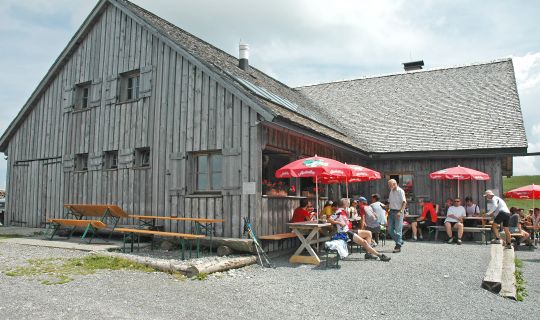
Refreshment options are available at the upper station of the Pfänderbahn and in Eichenberg, Möggers, Hohenweiler, Hörbranz, Lochau and Bregenz. Opening times should be checked in advance.

Attractive places to stop for a break can be found on the Pfänder ridge, beside Ramsacher Weiher and along the shores of Lake Constance. At Hasenreuter Waterfall, visitors should be considerate of the sensitive and often damp surroundings.

Pfänderbahn and costs:

The ascent on the Pfänderbahn is required for this tour and is subject to a charge. Bicycles are transported during operating hours. Different conditions and fares for bicycle transport may apply depending on the time of day. Current operating times, prices and periods when bicycles are transported free of charge should be checked directly with the Pfänderbahn in advance.

Tour category and suitability:

The tour belongs to the “Räder halt” category. The main focus is on the landscape, views and natural attractions.

The approximately 35-kilometre route includes around 190 metres of ascent and approximately 790 metres of descent. The main route is technically easy, but the tour is classified as moderate overall due to its length, the extended descents and several sections on public roads.

The route is not suitable for barrier-free access. Due to the road traffic and long descents, it is not recommended for families with young children.

Shortcuts and exit points:

The tour can be ended early in Hohenweiler, Hörbranz or Lochau, among other places. Public transport connections and the relevant arrangements for taking bicycles on board should be checked in advance.

Time of day:

Starting in the morning is recommended. This allows sufficient time for the Pfänderbahn journey, breaks and the detour to the waterfall. On hot days, the higher sections of the route are more pleasant in the morning.

Swimming:

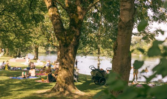
In suitable conditions, Lake Constance provides an opportunity to cool off after the tour. Local bathing areas and the applicable regulations must be observed.

Best time of year:

May to October, provided the route is free from snow and ice. After heavy rainfall, the approach to Hasenreuter Waterfall may be slippery or only accessible to a limited extent.

Tour-Quickfacts
Difficulty
moderate
Distance
35,2 km
Duration
03:00h
Ascent
190m
Descent
790m