

Reichenfeld - Buddhistisches Kloster Letztehof - Stadtschrofen - Felsenauschlucht

@ Nadine Jochum / Bodensee-Vorarlberg Tourismus GmbH

@ Nadine Jochum / Bodensee-Vorarlberg Tourismus GmbH

@ Nadine Jochum / Bodensee-Vorarlberg Tourismus GmbH

@ Nadine Jochum / Bodensee-Vorarlberg Tourismus GmbH

Stadtmarketing und Tourismus Feldkirch / Bodensee-Vorarlberg Tourismus GmbH
Details
| Kondition | |
| Landschaft | |
| Technik | |
| Schwierigkeit | leicht |
| Erlebnis | |
| Höchster Punkt | 608 m |
| Tiefster Punkt | 456 m |
Beste Jahreszeit
| Jan | Feb | Mär | Apr | Mai | Jun |
| Jul | Aug | Sep | Okt | Nov | Dez |
Öffentliche Verkehrsmittel
Elisabethplatz (Stadtbus Feldkirch, Linien 3 und 6)
Parken
In der Innenstadt befinden sich zahlreiche Parkplätze sowie Parkhäuser.
Wegbeschreibung
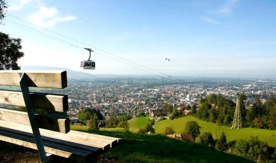
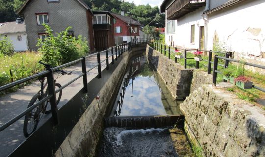
Wir gehen über den Illsteg und durchqueren das städtische Naherholungsgebiet Reichenfeld bis zum Pavillon. Von dort führt ein Fußweg hangaufwärts durch eine artenvielfältige Streuobstwiese bis zur Duxgasse. Wir folgen diesem tief eingeschnittenen alten Hohlweg, der bis 1540 Landstraße nach Frastanz/Bludenz war und mit seinen heute noch sichtbaren offenen Wasserfassungen auch der Wasserversorgung für den Ortsteil Heilig Kreuz/Illbruck diente. Auffällig hier ist auch eine dreistämmige Winderlinde, eines der Feldkircher Naturdenkmale. Am Ende der Duxgasse halten wir uns links und gehen am Letzehof, der heute als buddhistisches Zentrum dient, vorbei, bis uns ein Wanderschild links zum Stadtschrofen weist. An diesem Aussichtspunkt angekommen, werden wir mit dem schönsten Blick auf Feldkirch belohnt. Auf dem Rückweg halten wir uns an der ersten Wegkreuzung links und erreichen bald wieder die Straße, der wir abwärts folgen. Nach etwa 100 Metern zweigt links der Wanderweg zur Felsenauschlucht ab. Bis in die Innenstadt Feldkirch (Leonhardsplatz) sind es dann nur mehr wenige Minuten.
Sicherheitshinweise
112 Euro-Notruf (funktioniert mit jedem Handy aus jedem Netz)
Parking
There are lots of parking spaces and multi-storey car parks in the city centre.
Directions
The walk leads over the Illsteg and crosses the Reichenfeld urban recreation area to the pavilion. From there, a footpath leads uphill through a meadow orchard with a variety of species to Duxgasse. It follows this deeply cut old hollow way, which was a country road to Frastanz / Bludenz until 1540 and also served to supply water to the Heilig Kreuz / Illbruck district (its open water catchments are still visible today). A small-leaved lime tree with three trunks, one of Feldkirch’s natural monuments, stands out here. As the trail comes to the end of Duxgasse, it heads to the left and passes the Letzehof, which today serves as a Buddhist centre, before a hiking sign directs walkers left to the Stadtschrofen. This vantage point rewards hikers with the most beautiful view of Feldkirch. The trail’s route back takes a left at the first crossroads and soon returns to the road and then continues along it downhill. The hiking trail to the Felsenauschlucht gorge branches left after around 100 metres. It’s then just a few minutes to the town centre of Feldkirch (Leonhardsplatz).
Safety instructions
https://www.vorarlberg.travel/en/safety-tips-on-the-mountain/
Tour-Quickfacts
Schwierigkeit
leicht
Strecke
3,7 km
Dauer
01:20h
Aufstieg
180hm
Abstieg
180hm