

Der Rheintal Radweg führt von Bregenz nach Feldkirch, entlang des Bodenseeufers und des Rheindamms.

Volker Preusser / Vorarlberg Tourismus

Simone Koch / Stadtmarketing und Tourismus Feldkirch GmbH
Details
| Kondition | |
| Landschaft | |
| Schwierigkeit | leicht |
| Erlebnis | |
| Höchster Punkt | 461 m |
| Tiefster Punkt | 397 m |
Beste Jahreszeit
| Jan | Feb | Mär | Apr | Mai | Jun |
| Jul | Aug | Sep | Okt | Nov | Dez |
Kurzbeschreibung
Vom Bregenzer Hafen bis in die Feldkircher Altstadt verbindet diese rund 46,8 Kilometer lange Radtour den Bodensee mit der Flusslandschaft des Vorarlberger Rheintals. Seeufer, weite Dammwege, der Alte Rhein und grüne Auen prägen den abwechslungsreichen Weg nach Süden. Die Strecke verläuft mit insgesamt rund 120 Höhenmetern im Aufstieg überwiegend flach. Technisch ist sie wenig anspruchsvoll, die Länge erfordert jedoch Grundkondition. Bade- und Rastmöglichkeiten am Wasser sowie der historische Stadtkern von Feldkirch machen sie besonders für genussorientierte Radfahrer:innen attraktiv.
Tourenbeschreibung
Die Radtour beginnt am Bregenzer Hafen, unmittelbar am Bodensee und führt vorbei an Schiffen am Hafen und der Seebühne der Bregenzer Festspiele entlang der Seepromenade. Zunächst verläuft die Strecke am Bodenseeufer entlang in Richtung Hard.
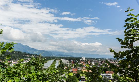
Von Hard führt der Rheintal-Radweg weiter zu den Dammwegen am Rhein und in Richtung Lustenau. Die Landschaft wird offener, die Wege führen durch die flache Talebene. Der Fluss, sein breites Vorland und die entfernten Bergketten bilden den Rahmen für diesen Abschnitt. Auf den längeren geradlinigen Passagen lässt sich ein gleichmäßiger Rhythmus finden; bei Wind kann das Vorankommen dennoch mehr Kraft verlangen, als das geringe Gefälle erwarten lässt.
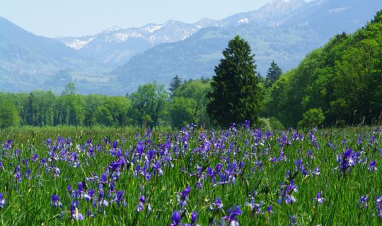
Im Raum Lustenau folgt die Tour dem Alten Rhein weiter in Richtung Hohenems. Hier zeigt sich der Unterschied zwischen dem regulierten Alpenrhein und den naturnahen Gewässerabschnitten des ehemaligen Flusslaufs besonders deutlich. Am Alten Rhein laden geeignete Bade- und Rastplätze zu einer Unterbrechung ein.
Bei Hohenems führt die Route am Gasthaus am Rohr vorbei und folgt dem Rhein weiter flussaufwärts. Über den Raum Mäder, Koblach und Meiningen geht es durch die weite Rheinebene. Lange Anstiege bleiben aus; insgesamt gewinnt die Strecke bis Feldkirch allmählich an Höhe.
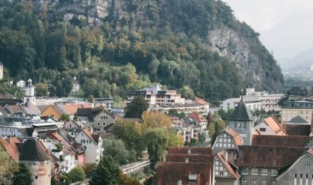
Hinter Meining zweigt die Strecke am Illspitz ab und führt entlang der Ill Richtung Feldkirch. Vorbei an den Baggerseen sowie dem Waldbad Feldkirch und dem Waldcampingplatz erreicht die Tour schließlich das Stadtzentrum. Nach den ausgedehnten Flusslandschaften bilden die historischen Gassen und Plätze der Altstadt einen reizvollen Abschluss. Die Schattenburg über der Stadt erinnert an Feldkirchs lange Geschichte. Für eine Pause oder einen Stadtbummel lohnt es sich, am Ziel noch etwas Zeit einzuplanen. Da Start und Ziel auseinanderliegen, bietet sich für die Rückreise die Bahn an.
Anreise
Ausgangspunkt der Tour ist der Bregenzer Hafen am Bodensee. Das Ziel liegt im Stadtzentrum von Feldkirch.
Mit den öffentlichen Verkehrsmitteln
Bushaltestelle Start: Bregenz Hafen Bahnhof
Bushaltestelle Ziel: Feldkirch Busplatz
Zughaltestelle Start: Bregenz Hafen
Zughaltestelle Ziel: Feldkirch Bahnhof
Der Bregenzer Hafen ist mit Bahn und Bus erreichbar. Vom Feldkircher Stadtzentrum gelangt man mit dem Fahrrad oder dem Stadtbus zum Bahnhof Feldkirch. Von dort bestehen Zugverbindungen zurück nach Bregenz. Für die Fahrradmitnahme im Zug gelten die jeweiligen Beförderungsbedingungen und Platzkapazitäten; passende Verbindungen bitte vorab prüfen.
Die Anreise mit Bahn und Bus ermöglicht einen direkten Start ohne Parkplatzsuche.
Hier der Link zur Anreiseplanung: vmobil.at
Mit dem Auto
Über die A14 bis zur Ausfahrt Bregenz fahren und anschließend durch den Citytunnel der Beschilderung Richtung Hafen beziehungsweise Reichsstraße folgen. Von dort ist der Ausgangspunkt am Bregenzer Hafen rasch erreichbar.
Parken
Empfohlen wird das Parkhaus Bregenz am Hafen, Reichsstraße 1, 6900 Bregenz. Das offizielle Parkhaus liegt in unmittelbarer Nähe des Ausgangspunkts. Es ist gebührenpflichtig. Aktuelle Bedingungen sind vor Ort zu beachten.
Sicherheitshinweise
Auf den Ufer- und Dammwegen ist Rücksicht auf Fußgänger:innen, andere Radfahrer:innen und Erholungssuchende erforderlich. In Ortsbereichen, an Straßenquerungen und bei Zufahrten ist auf den übrigen Verkehr zu achten. Die Geschwindigkeit sollte insbesondere an belebten Bade- und Rastplätzen angepasst werden.
Offene Abschnitte am Rhein können windig sein und bei Sonne wenig Schatten bieten. Bei Regen ist auf feuchte oder verschmutzte Wegstellen zu achten. Ausreichend Trinkpausen einplanen und die Natur- und Uferbereiche nur auf zulässigen Wegen befahren.
Zusatzinformationen
Die Uferbereiche des Bodensees, der Alte Rhein und die Rheinauen eignen sich für Pausen am Wasser. An ausgewiesenen Badeplätzen ist bei passendem Wetter auch eine Abkühlung möglich. Rücksicht auf geschützte Uferabschnitte und die örtlichen Badehinweise ist wichtig.
Für eine Einkehr bieten sich insbesondere Bregenz, das Gasthaus am Rohr und Feldkirch an. In Feldkirch lässt sich die Radtour mit einem Spaziergang durch die Altstadt oder einem Besuch der Schattenburg verbinden. Für die Rückfahrt empfiehlt sich die Kombination mit dem Zug; die Fahrradmitnahme sollte vor Reiseantritt geprüft werden.
Short description
From Bregenz Harbour to Feldkirch's old town, this cycle tour of around 46.8 kilometres links Lake Constance with the riverside landscapes of the Vorarlberg Rhine Valley. Lakeside paths, open embankments, the Old Rhine and green floodplains shape the varied journey southwards. With approximately 120 metres of ascent, the route is predominantly flat. It is not particularly demanding technically, although the distance calls for a basic level of fitness. Places to swim and rest beside the water, together with Feldkirch's historic centre, make it especially appealing to leisure cyclists.
Description
The cycle tour begins at Bregenz Harbour, right on the shores of Lake Constance, and passes the boats in the harbour and the Bregenz Festival’s floating stage as it follows the lakeside promenade. Initially, the route runs along the shore of Lake Constance towards Hard.
From Hard, the Rheintal Cycle Route continues towards the paths along the Rhine embankments and on towards Lustenau. The landscape becomes more open as the route crosses the flat valley floor. The river, its wide floodplain and the distant mountain ranges provide the backdrop for this section. The long, straight stretches make it easy to settle into a steady rhythm, although headwinds can make cycling more demanding than the gentle gradients might suggest.
In the Lustenau area, the tour follows the Old Rhine towards Hohenems. Here, the contrast between the regulated Alpine Rhine and the more natural stretches of the former river course becomes particularly apparent. Along the Old Rhine, suitable swimming spots and rest areas offer opportunities to take a break.
Near Hohenems, the route passes Gasthaus am Rohr and continues upstream along the Rhine. It then crosses the wide Rhine Valley through the areas around Mäder, Koblach and Meiningen. There are no long climbs, although the route gradually gains elevation on its way to Feldkirch.
Beyond Meiningen, the route branches off at the Illspitz, where the Ill meets the Rhine, and follows the Ill towards Feldkirch. Passing the gravel pit lakes, Waldbad Feldkirch outdoor swimming pool and the Waldcamping campsite, the tour eventually reaches the town centre. After the expansive riverside landscapes, the historic streets and squares of the old town provide an attractive conclusion to the ride. Schattenburg Castle, overlooking the town, is a reminder of Feldkirch’s long history. It is worth allowing some extra time for a break or a stroll through the town before heading home. As the tour starts and finishes in different locations, travelling back by train is a convenient option.
Public transport
The tour starts at Bregenz Harbour on Lake Constance and finishes in the centre of Feldkirch.
By public transport
Bus stop at the start: Bregenz Hafen Bahnhof
Bus stop at the finish: Feldkirch Busplatz
Train station at the start: Bregenz Hafen
Train station at the finish: Feldkirch railway station
Bregenz Harbour is accessible by train and bus. From the centre of Feldkirch, the railway station can be reached by bicycle or local bus. Trains run from there back to Bregenz. Bicycle carriage is subject to the relevant railway conditions and available space, so please check suitable connections in advance.
Travelling by train and bus allows you to start the route without searching for a parking space.
Plan your journey at vmobil.at
By car
Follow the A14 motorway to the Bregenz exit, then travel through the Citytunnel and follow signs for the harbour or Reichsstraße. The starting point at Bregenz Harbour is a short distance away.
Parking
The recommended option is Parkhaus Bregenz am Hafen, Reichsstraße 1, 6900 Bregenz. This official car park is very close to the starting point. Parking charges apply; please observe local parking rules and time restrictions.
Directions
The cycling route leads from Bregenz harbour along the shores of Lake Constance to Hard.It continues from Hard along the Rhine embankment to Lustenau. The cycle path then follows the Alte Rhein (Old Rhine) to Hohenems.It continues upstream along the Rhine and passes the large Erholungszentrum Rheinauen (Leisure Centre) in Hohenems, the Sportplatz Mäder (Sports Ground), the Zollamt Koblach (Customs Office) and the Zollhaus Meiningen (Customs House). Passing quarry lakes, the Waldbad Feldkirch (Swimming Baths) and the Waldcampingplatz (Camping Site), the cycle path leads directly into the town centre of Feldkirch.
Equipment
A roadworthy touring or trekking bike is suitable for the predominantly flat route; an e-bike can also be used. Recommended items include a cycle helmet, clothing suitable for the weather, protection against wind and sun, sufficient drinking water, a small repair kit and a bicycle lock. Pack swimwear and a towel if you would like to stop for a swim at Lake Constance or the Old Rhine.
Safety information
On lakeside and embankment paths, be considerate towards pedestrians, other cyclists and people enjoying the area. Watch for other traffic in built-up areas, at road crossings and near access roads. Adjust your speed, particularly around busy bathing and rest areas.
Exposed stretches beside the Rhine can be windy and offer little shade in sunny weather. In wet conditions, watch out for damp or dirty sections of path. Plan sufficient drinking breaks and use only permitted routes through natural areas and along the riverbanks.
Additional Information
The shores of Lake Constance, the Old Rhine and the Rhine floodplains are inviting places to stop beside the water. In suitable weather, designated bathing areas also provide opportunities for a refreshing swim. Please respect protected stretches of shoreline and follow local bathing guidance.
Places to eat can be found in Bregenz, in the settlements along the route for example "Gasthof am Rohr" and in Feldkirch. In Feldkirch, the ride can be combined with a walk through the old town or a visit to Schattenburg Castle. Returning by train is a convenient option; check the arrangements for taking bicycles on board before travelling.

Tour-Quickfacts
Schwierigkeit
leicht
Strecke
46,6 km
Dauer
03:30h
Aufstieg
60hm
Abstieg
0hm