

Aussichtsreiche Wanderung von der Bergstation der Pfänderbahn über den Bregenzer Ortsteil Fluh und den Buchwaldweg zum Restaurant Gebhardsberg. Anschließend über den Stadtwald zur mittelalterlichen Oberstadt von Bregenz und zurück zur Talstation.
Autorentipp
Diese Wanderung kann natürlich auch in umgekehrter Richtung erfolgen. Knieschonend geht es dann 600 Hm mit der Pfänderbahn zu Tal.

Erich Zucalli / Erich Zucalli / www.guideservice.at

Erich Zucalli / Erich Zucalli / www.guideservice.at

Erich Zucalli / Erich Zucalli / www.guideservice.at

Erich Zucalli / Erich Zucalli / www.guideservice.at

Erich Zucalli / Erich Zucalli / www.guideservice.at

Erich Zucalli / Erich Zucalli / www.guideservice.at

Erich Zucalli / Erich Zucalli / www.guideservice.at

Erich Zucalli / Erich Zucalli / www.guideservice.at

Erich Zucalli / Erich Zucalli / www.guideservice.at

Erich Zucalli / Erich Zucalli / www.guideservice.at

Erich Zucalli / Erich Zucalli / www.guideservice.at

Erich Zucalli / Erich Zucalli / www.guideservice.at

Erich Zucalli / Erich Zucalli / www.guideservice.at

Erich Zucalli / Erich Zucalli / www.guideservice.at

Erich Zucalli / Erich Zucalli / www.guideservice.at

Erich Zucalli / Erich Zucalli / www.guideservice.at

Erich Zucalli / Bodensee-Vorarlberg Tourismus GmbH
Details
| Kondition | |
| Landschaft | |
| Technik | |
| Schwierigkeit | mittel |
| Erlebnis | |
| Höchster Punkt | 1020 m |
| Tiefster Punkt | 418 m |
Beste Jahreszeit
| Jan | Feb | Mär | Apr | Mai | Jun |
| Jul | Aug | Sep | Okt | Nov | Dez |
Beschreibung
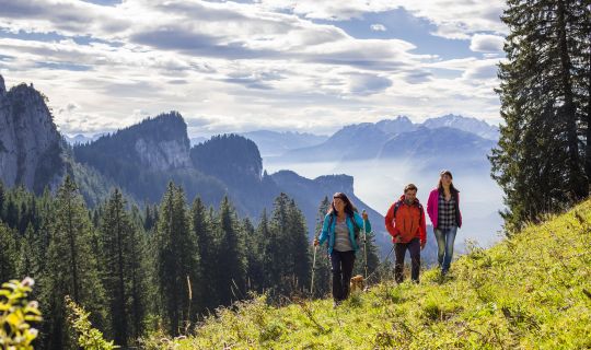
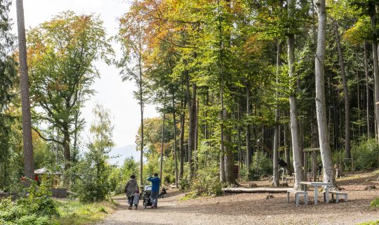
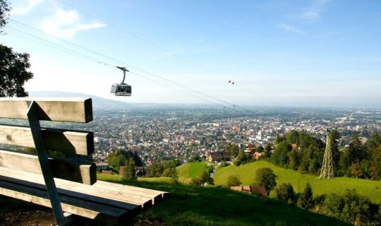
Die Pfänderbahn in Bregenz bringt Sie in nur 6 Minuten auf den Pfänder (1064m). Hier können Sie einen der schönsten Aussichtspunkte der Bodenseeregion genießen mit dem grandiosen Rundblick über den Bodensee, das Rheintal, die Schweizer Berge und den Bregenzerwald. Der Abstieg (620 Hm) folgt breiten Wanderwegen, großteils in schattenspendendem Wald. Zwischen dem Ortsteil Fluh und der Landesbibliothek finden wir immer wieder Infotafeln zum Waldlehrpfad. Beim Restaurant Gebhardsberg empfiehlt sich die Besichtigung der Burgruine Hohenbregenz mit der Wallfahrtskirche des Heiligen Gebhard. Hinter der Kirche gibt es einen Aussichtspunkt mit Blick über das Rheintal bis in die Schweizer Berge. Auch unterhalb des Restaurants eröffnet sich ein toller Ausblick auf den Bodensee, mit Rheinmündung und der Insel Lindau. Durch den Stadtwald kommen Sie in die mittelalterliche Oberstadt von Bregenz mit dem Martinsturm als Wahrzeichen der Hauptstadt von Vorarlberg.
Anfahrt
Von Norden über die A14 bis zur Ausfahrt Lochau-Hörbranz, dann durch Lochau Richtung Bregenz dem See entlang bis zum ersten Kreisverkehr in Bregenz, dort links abbiegen. Nach 200m wieder links abbiegen und dann rechts in den Parkplatz Pfänderbahn einbiegen.
Von Süden über die A14 bis zur Ausfahrt Bregenz, dann durch den Citytunnel nach Bregenz. Nach dem Tunnel rechts abbiegen und der Straßefolgen, vorbei am Bahnhof, bis zum Kreisverkehr, dort die 2. Ausfahrt leicht aufwärts, nach 200m links abbiegen und dann gleich rechts in den Parkplatz Pfänderbahn einbiegen.
Öffentliche Verkehrsmittel
Mit dem Zug bis Bahnhof Bregenz, dann mit der Stadtbuslinie 101 (fährt täglich) zur Station "Pfänderbahn" oder mit dem Zug bis Bahnhof Bregenz Hafen, und von dort zu Fuß ca. 5 Minuten bis zur Talstation der Pfänderbahn.
Parken
Parkplatz Pfänderbahn
Wegbeschreibung
Von der Bergstation (1025m) führt eine asphaltierte Straße zum Gasthof Pfänderdohle (975m) und mündet dann in einen breiten Forstweg bis zum Ortsteil Bregenz/Fluh (770m), der nach einer guten Stunde erreicht wird. Weiter geht es rechts ca. 300m der Straße entlang, bis der Wanderweg nach dem Wanderparkplatz wieder links abzweigt. Nach Überquerung eines kleinen Trockentales beginnt der Buchwaldweg (Teil des Waldlehrpfads) Richtung Gebhardsberg (Teil des Jakobswegs, siehe Pilgermuschel). Kurz vor dem Parkplatz führt ein Weg zur ehemaligen Burgruine Hohenbregenz und zur Wallfahrtskirche (575m). Durch das Gasthaus führt eine Stiege zur unteren Aussichtsplattform. Weiter führt dann der Weg über einen Teil des Waldlehrpfades zur Landesbibliothek (455m). Danach den Wegweisern „Oberstadt“ folgend in die mittelalterliche Oberstadt. Weiter führt uns der Wegweiser „Pfänderbahn“ zurück zum Ausgangspunkt bei der Talstation der Pfänderbahn (425m).
Ausrüstung
Leichte Wanderschuhe mit Profilsohle und Wanderstöcke
Regenschutz und Trinken nicht vergessen
Zusatzinformationen
Bitte beachten Sie die Öffnungszeiten der Pfänderbahn
Brief description
A panoramic hike from the Pfänderbahn's mountain station through the Fluh district of Bregenz and the Buchwaldweg to the Gebhardsberg restauarant. Then via the city forest to the medieval upper town of Bregenz and back to the valley station.
Description
The Pfänderbahn in Bregenz takes hikers up to the Pfänder (1064 m) in just six minutes. This is where one of the Lake Constance region’s most beautiful vantage points with its magnificent panoramic view over Lake Constance, the Rhine Valley, the Swiss mountains and the Bregenzerwald may be enjoyed.The descent (620 m) follows wide hiking trails, mostly in shady woods. Information boards providing details about the forest nature trail are to be found between the Fluh district and the regional library. A detour to the castle ruins of Hohenbregenz with its pilgrimage church of St. Gebhard at the Gebhardsberg restaurant is recommended. There is a vantage point behind the church that presents a view across the Rhine Valley to the Swiss mountains. A great vista of Lake Constance, with Rhine delta and the island of Lindau may also be enjoyed from below the restaurant. The trail takes walkers through the city forest to the medieval upper town of Bregenz where the Martinsturm (tower) stands as the landmark of the capital of Vorarlberg.
Approach
From the north via the A14 to the Lochau-Hörbranz exit, then through Lochau towards Bregenz along the lake to the first roundabout in Bregenz, it’s a left turn there. Turn left again after 200 metres and then turn right into the Pfänderbahn car park.
From the south via the A14 to the exit for Bregenz, then through the City Tunnel to Bregenz. Turn right after the tunnel and follow the road past the railway station up to the roundabout, then take the 2nd exit slightly uphill, turn left after 200 metres and then immediately right into the Pfänderbahn car park.
Public transport
By train to Bregenz, then with the No. 1 city bus (runs daily) to the Pfänderbahn’s valley station.
Parking
Pfänderbahn parking lot
Directions
An asphalt road leads from the mountain station (1025 m) to the Gasthof Pfänderdohle (975 m) (which is an inn) and then crosses into a wide forest path that after a good hour takes walkers to the Bregenz / Fluh district (770 m). The walk continues directly along the road for approximately 300 metres until the trail branches off again to the left after the Wanderparkplatz (car park for walkers). The Buchwaldweg (part of the forest nature trail) commences after the route crosses a small dry valley and leads on towards Gebhardsberg (part of the Road to Santiago, look out for scallop symbols). A path shortly before the parking lot leads to the castle ruins of Hohenbregenz and to the pilgrimage church (575 m). A staircase in the inn leads to the lower viewing platform. The path then continues along part of the forest nature trail to the regional library (455 m). The route to the medieval upper town (‘Oberstadt’) is signposted from there. The signs for the ‘Pfänderbahn’ take walkers back to the starting point at the Pfänderbahn’s valley station (425 m).
Equipment
Light hiking shoes with profiled soles and hiking poles
Drinks and protection from the rain should not be forgotten.
Tips
It is, of course, possible to take the route in the opposite direction. The return trip to the valley may then be made from a height of 600 metres with the Pfänderbahn, which would consequently be more gentle on the knees.
Additional information
Please note the Pfänderbahn’s operating times.
https://www.pfaenderbahn.at/de/
Tour-Quickfacts
Schwierigkeit
mittel
Strecke
8,5 km
Dauer
02:30h
Aufstieg
0hm
Abstieg
600hm