Illspitz

Radrunde ab Koblach zum Illspitz und durch das Rheintal

GPX KML

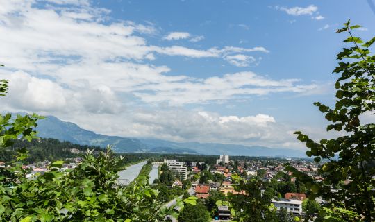
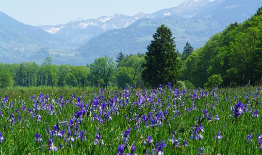
Die rund 46,5 Kilometer lange Radrunde verbindet die offenen Wiesen des Rheintals mit den Ortschaften Rankweil, Göfis, Satteins und Feldkirch. Vom Sportplatz Lohma in Koblach geht es zunächst durch die Talebene, bevor ein Anstieg in Richtung Schwarzer See für einen landschaftlichen Wechsel sorgt.

Anschließend prägen die Ill, die weiten Felder bei Bangs und der Alpenrhein den Weg. Ein besonderer Höhepunkt ist der Illspitz, wo die Ill in den Rhein mündet. Die Länge der Runde und die Steigung bei Göfis verlangen etwas Ausdauer; große Teile des übrigen Streckenverlaufs sind vergleichsweise flach.

Details

Kondition
      
Landschaft
      
Technik
      
Erlebnis
      
Schwierigkeitmittel
Höchster Punkt567 m
Tiefster Punkt418 m
Beste Jahreszeit
JanFebMärAprMaiJun
JulAugSepOktNovDez
Tourenbeschreibung

Die Rundtour beginnt bei der Sportanlage Lohma in Koblach. Zunächst führt die Strecke durch ein Wohngebiet und anschließend über offene Felder in Richtung Klaus. Sie passiert den Unternehmensstandort von Alpin Loacker und verläuft danach erneut durch Wiesen und landwirtschaftlich geprägte Flächen. Auf dem Weg nach Rankweil kommt die Runde am Golfclub Montfort Rankweil vorbei, dessen Golfanlage in der weiten Landschaft des Rankweiler Weitrieds liegt.

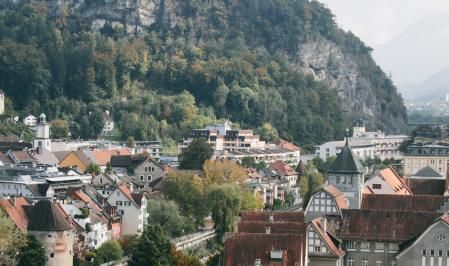
Durch Wohngebiete geht es weiter ins Zentrum von Rankweil. Die weithin sichtbare Basilika auf dem Liebfrauenberg prägt das Ortsbild und ist ein markanter kultureller Höhepunkt entlang der Tour. Anschließend steigt die Strecke leicht in Richtung Neslers Bühel und Landeskrankenhaus Rankweil an. Die offene Talebene geht allmählich in die bewaldeteren Hänge oberhalb des Ortes über.

Die Runde setzt sich in das Gemeindegebiet von Göfis fort und führt am Gasthaus Stern vorbei. Der Anstieg wird hier deutlicher, während sich die Umgebung zunehmend von Siedlungsbereichen zu Wald und hügeligem Gelände verändert. Kurz hinter dem Schwarzen See erreicht die Tour ihren höchsten Punkt.

Von dort führt die Strecke wieder bergab ins Zentrum von Satteins. Sie passiert die Pfarrkirche zum heiligen Georg, deren markanter Turm das Ortsbild mitprägt. Anschließend verläuft die Route durch Schlins und überquert die Ill. Damit beginnt ein längerer Abschnitt, auf dem der Fluss die Landschaft und den Charakter der Radtour bestimmt.

Entlang der Ill führt die Runde weiter nach Frastanz. Die Uferbereiche wechseln zwischen offenem Gelände und begrünten Abschnitten, während die Strecke wieder überwiegend geringe Höhenunterschiede aufweist. Auch hinter Frastanz bleibt die Ill ein beständiger Begleiter der Fahrt.

Im weiteren Verlauf passiert die Tour das Restaurant ILLSIDE an der Ill und erreicht das Gebiet von Feldkirch. Die Strecke orientiert sich weiter am Fluss und führt in Richtung Nofels. Der Wechsel zwischen Stadtgebiet und Flusslandschaft macht diesen Teil besonders abwechslungsreich.

Von Nofels geht es über Wiesen und Felder weiter nach Bangs. Im westlichsten Ortsteil von Feldkirch führt die Tour am Gasthaus Stern vorbei. Hier öffnen sich die Blicke über die weitläufige Landschaft im Grenzraum zur Schweiz und zu Liechtenstein. Anschließend erreicht die Runde den Rhein.

Dem Rhein folgend führt die Strecke zum Illspitz, wo die Ill in den Rhein mündet. Am Zusammenfluss der beiden Gewässer zeigt sich die besondere Bedeutung der Flüsse für die Landschaft des Rheintals. In der Nähe liegt das Kraftwerk Illspitz, dessen Errichtung mit ökologischen Maßnahmen an der Ill verbunden war.

Vom Illspitz verläuft die Runde weiter am Rhein entlang zurück in Richtung Koblach. Die weiten Flussräume, die Dämme und die angrenzenden Grünflächen begleiten den letzten Abschnitt bis zur Sportanlage Lohma, wo sich die Runde schließt. Ein Einstieg ist auch an anderen geeigneten und gut erreichbaren Punkten entlang der Strecke möglich.

Anreiseinformation

Ausgangspunkt und Ziel der Tour ist das westliche Ortsgebiet von Koblach, nahe der Sportanlage Lohma.

Mit den öffentlichen Verkehrsmitteln

Bushaltestelle Start/Ziel: Koblach Dorfmitte; von dort ist der Ausgangspunkt im westlichen Ortsgebiet zu erreichen.

Zughaltestelle Start/Ziel: Bahnhof Götzis; in Koblach selbst gibt es keinen Bahnhof.

Vom Bahnhof Götzis bestehen Busverbindungen in Richtung Koblach, unter anderem zur Haltestelle Dorfmitte. Bitte prüfen Sie die aktuelle Verbindung und die Bedingungen für die Fahrradmitnahme vor der Anreise.

Link zur Anreiseplanung: vmobil.at

Mit dem Auto

Die Anreise erfolgt über die A14 Rheintal/Walgau Autobahn, beispielsweise über die Anschlussstelle Klaus-Koblach, und weiter auf den Landes- und Gemeindestraßen ins Ortszentrum von Koblach. Beachten Sie aktuelle Verkehrsführungen und mögliche Baustellen.

Parken

Empfohlen wird der Parkplatz Dorfmitte beim Gemeindezentrum Koblach, Werben 9. Von dort ist der Ausgangspunkt im westlichen Ortsgebiet in kurzer Entfernung erreichbar. Bitte beachten Sie die aktuellen Parkregelungen vor Ort.

Ausrüstung

Ein gut gewartetes Touren- oder Trekkingrad, ein Fahrradhelm sowie wetterangepasste Kleidung sind empfehlenswert. Nehmen Sie ausreichend Trinkwasser, einen kleinen Snack, ein Reparaturset und eine Fahrradpumpe mit. Für die längere Strecke ist auch eine Navigationsmöglichkeit sinnvoll.

Sicherheitshinweise

An Kreuzungen und auf Ortsstraßen ist auf den Verkehr zu achten. Auf gemeinsam genutzten Damm- und Uferwegen haben auch Fußgänger:innen und andere Erholungssuchende Platz. Der kurze Anstieg und die anschließende Abfahrt erfordern angemessene Gangwahl und kontrolliertes Tempo. Bei Hochwasser können Flusswege beeinträchtigt oder gesperrt sein; bei sommerlicher Hitze sind die offenen Talabschnitte teilweise wenig schattig. Beachten Sie örtliche Beschilderungen und allfällige Wegsperren.

Zusatzinformationen

Der Illspitz ist ein besonderer Ort für eine Pause am Zusammenfluss von Ill und Alpenrhein. Das Kraftwerk Illspitz wurde 2014 eröffnet und mit Maßnahmen zur Verbesserung des Gewässerlebensraums verbunden. Informationen zum Flussraum und zu den Radwegen an Rhein und Frutz bietet auch die Gemeinde Koblach.

Für eine Einkehr vor oder nach der Tour bietet sich das Restaurant Dorfmitte im Zentrum von Koblach an; die aktuellen Öffnungszeiten sollten vorab geprüft werden. Im Gemeindeamt Koblach befindet sich zudem das Museum für Urgeschichte, das einen Einblick in die frühe Besiedlung des Kummenbergs gibt.

Short description

This approximately 46.5-kilometre circular cycle route links the open meadows of the Rhine Valley with Rankweil, Göfis, Satteins and Feldkirch. Starting at the Lohma sports ground in Koblach, it first crosses the valley floor before a climb towards Schwarzer See brings a change of scenery.

The River Ill, the extensive fields around Bangs and the Alpine Rhine then shape the ride. One particular highlight is Illspitz, where the Ill flows into the Rhine. The length of the tour and the climb near Göfis require a reasonable level of stamina, while much of the remaining route is relatively flat.

Detailed description

The circular tour starts at the Lohma sports ground in Koblach. It initially leads through a residential area before crossing open fields towards Klaus. The route passes the Alpin Loacker company premises and then continues through meadows and farmland. On the way to Rankweil, the tour passes Montfort Rankweil Golf Club, whose course lies amid the open landscape of the Rankweiler Weitried.

The route continues through residential neighbourhoods into the centre of Rankweil. The prominent basilica on Liebfrauenberg dominates the townscape and is a notable cultural highlight along the ride. The route then climbs gently towards Neslers Bühel and Rankweil Regional Hospital. The open valley floor gradually gives way to the more wooded hillsides above the town.

The circular route continues into the municipality of Göfis and passes Gasthaus Stern. The climb becomes more noticeable here as the surroundings change from residential areas to woodland and rolling terrain. Shortly beyond Schwarzer See, the tour reaches its highest point. Set among wooded slopes, the small lake provides a peaceful contrast to the earlier ride across the Rhine Valley.

From here, the route descends into the centre of Satteins. It passes the parish church of St George, whose distinctive tower helps define the village skyline. The tour then continues through Schlins and crosses the River Ill. This marks the beginning of a longer section in which the river shapes both the landscape and the character of the ride.

Following the River Ill, the circular tour continues towards Frastanz. The riverbanks alternate between open areas and green stretches, while the route once again has relatively little change in elevation. Beyond Frastanz, the Ill remains a constant companion.

Further along, the route passes the ILLSIDE restaurant beside the Ill and enters the Feldkirch area. Rather than staying entirely within the town centre, the route continues to follow the river towards Nofels. The alternating urban surroundings and riverside scenery make this section particularly varied.

From Nofels, the tour crosses meadows and fields towards Bangs. In this westernmost district of Feldkirch, the route passes another Gasthaus Stern. Here, views open up across the broad landscape near the borders with Switzerland and Liechtenstein. The circular route then reaches the Alpine Rhine.

Following the Rhine, the route leads to Illspitz, where the River Ill joins the Alpine Rhine. The confluence illustrates the important role that the rivers play in shaping the Rhine Valley landscape. Nearby stands the Illspitz power station, whose construction was accompanied by ecological improvements along the Ill.

From Illspitz, the route continues alongside the Rhine back towards Koblach. The broad river landscape, embankments and adjoining green spaces accompany the final stretch to the Lohma sports ground, where the circular tour comes to an end. It is also possible to join the tour at other suitable, easily accessible points along the route.

Getting there

The tour starts and finishes at the Lohma sports ground, Siedlung 12, in Koblach.

By public transport

Bus stop at the start/finish: Koblach Dorfmitte; the Lohma sports ground can be reached by bicycle from here.

Train station at the start/finish: Götzis railway station; Koblach does not have its own railway station.

Bus services run from Götzis railway station to Koblach. Please check current connections and bicycle carriage conditions before travelling.

Journey planner: vmobil.at

By car

Take the A14 Rheintal/Walgau motorway, for example using the Klaus-Koblach junction, and continue along local roads towards Koblach. The Lohma sports ground is located on Siedlung road.

Parking

The recommended option is Dorfmitte car park by the Koblach municipal centre, Werben 9. From here, you can cycle to the Lohma sports ground. Please observe the current parking regulations and any signed parking restrictions, particularly along Siedlung road.

Equipment

A roadworthy touring or trekking bike, a cycle helmet and clothing suited to the weather are recommended. For the longer ride, bring sufficient drinking water, a small snack, a repair kit, a pump and a suitable means of navigation.

Safety information

Take particular care in town and village centres, residential areas and at road crossings. Select an appropriate gear for the climb towards Schwarzer See, and keep your speed under control on the subsequent descent into Satteins. Be considerate towards pedestrians and other cyclists on shared paths along the Ill and Rhine. High water levels or heavy rainfall may affect riverside paths. Follow local signs and any temporary closures.

Additional information

Places to stop for refreshments along or near the route include Gasthaus Stern in Göfis and Gasthaus Stern in Feldkirch-Bangs. In Koblach, Restaurant Dorfmitte is another option before or after the ride. Please check opening times and, where necessary, access from the route in advance.

Illspitz is an interesting place to experience the confluence of the River Ill and the Alpine Rhine. The Illspitz power station, opened in 2014, was accompanied by measures to improve the river's ecology. Visitors interested in culture may also wish to take a closer look at Rankweil Basilica and the parish church of St George in Satteins.

Tour-Quickfacts
Schwierigkeit
mittel
Strecke
46,4 km
Dauer
02:00h
Aufstieg
160hm
Abstieg
160hm