.jpg.jpeg

Lake vistas: Möggers – Pfänder ridge

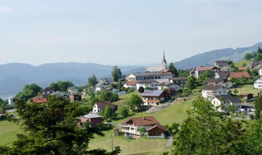
What enchanting scenery! En route, the views of Lake Constance, gently undulating hillsides lining the lakeshore, and of the Vorarlberg mountains, change in constant succession, offering a truly unforgettable sight in every kind of weather.

Möggers-Weienried (841 m) – Möggers village (979 m) – Hochberg – Schüssellehen – Ried – Weienried

Author tip

1 lake – 4 countries

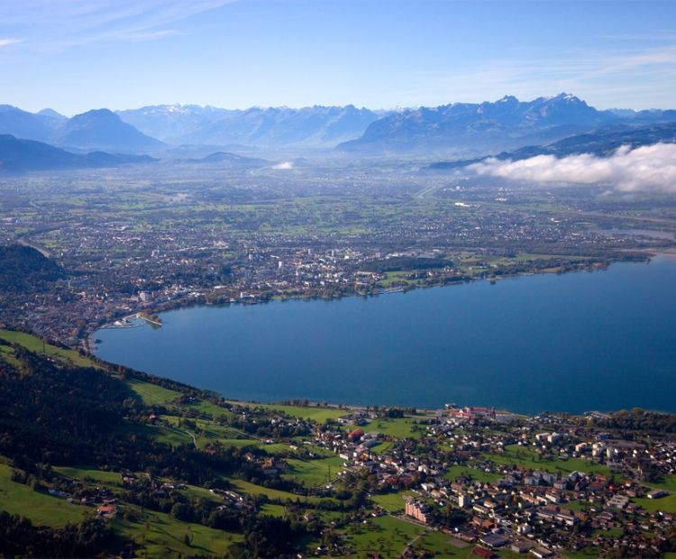
The size of Lake Constance is best fathomed from above. With a surface area of 536 km² it is the largest lake in Central Europe. Its shoreline is 273 km long, with Germany taking the lion share (173 km). The Swiss shoreline is 72 km, Austria’s accounts for 28 km. The principality of Liechtenstein also forms part of this region of shared culture and language.

The landscapes around the lake will leave you awe-struck for their diversity. Towards the north, gently undulating hills and wide land surfaces extend under your eyes. Fruit, vegetables, cereals and hop are farmed on the fertile soils. In the south, you can make out the gradually rising Alps. During the summer months, a number of vessels cruise on the lake. From Bregenz, Vorarlberg Lines run services to all major ports, such as to the island town of Lindau, to Friedrichshafen with the Zeppelin and Dornier Museums, as well as to the flower island of Mainau at the far end of the lake.

Details

Stamina
      
Landscape
      
Technique
      
Difficultyeasy
Experience
      
Highest point1064 m
Best time of year
JanFebMarAprMayJun
JulAugSepOctNovDec
Brief description

What enchanting scenery! En route, the views of Lake Constance, gently undulating hillsides lining the lakeshore, and of the Vorarlberg mountains, change in constant succession, offering a truly unforgettable sight in every kind of weather.

Public transport
Parking

Möggers-Weienried – parking

Directions

This panoramic circuit trail starts from Möggers-Weienried (car park, bus stop). From here you head in the direction of Möggers, along grassland, crossing a forest, reaching Hochberg. The trail runs under the summit cross, a detour to this panoramic look-out is certainly worth the effort (1,069 m). Passing Schüssellehen, where you will come across a remote farmhouse, and the marshland, you continue in the direction of Weienried. Between Ried and Weienried you can cool your feet in a natural Kneipp pool along the water trail.

Safety instructions

EMERGENCY NUMBERS:
140 alpine emergencies Austria
144 alpine emergencies Vorarlberg
112 Euro emergency call (if there is no reception at the site of the emergency, first switch off your mobile phone, and when switching it on again, immediately dial 112 or press the SOS button instead of entering the PIN code).
www.vorarlberg.travel/safety

Tips
1 lake – 4 countries

The size of Lake Constance is best fathomed from above. With a surface area of 536 km² it is the largest lake in Central Europe. Its shoreline is 273 km long, with Germany taking the lion share (173 km). The Swiss shoreline is 72 km, Austria’s accounts for 28 km. The principality of Liechtenstein also forms part of this region of shared culture and language.

The landscapes around the lake will leave you awe-struck for their diversity. Towards the north, gently undulating hills and wide land surfaces extend under your eyes. Fruit, vegetables, cereals and hop are farmed on the fertile soils. In the south, you can make out the gradually rising Alps. During the summer months, a number of vessels cruise on the lake. From Bregenz, Vorarlberg Lines run services to all major ports, such as to the island town of Lindau, to Friedrichshafen with the Zeppelin and Dornier Museums, as well as to the flower island of Mainau at the far end of the lake.
Tour-Quickfacts
Difficulty
easy
Distance
11,1 km
Duration
03:00h
Ascent
345m
Descent
345m